I am an urban and regional planner with expertise in geospatial analysis, data visualization, research and Python development.
I specialize in using AutoCAD, ArcGIS, QGIS, Power BI, Python (Django and FastAPI) and PostgreSQL to create interactive maps, dashboards, APIs and automated workflows that enable data-driven urban development. Based in Lagos, Nigeria, and open to opportunities globally.
Find routes from community hubs in Lagos to nearby destinations. Choose a hub and a destination to see the route, distance and travel time. You can limit results to a 1 km buffer, use your location, open directions in Google Maps and share a link to any route.
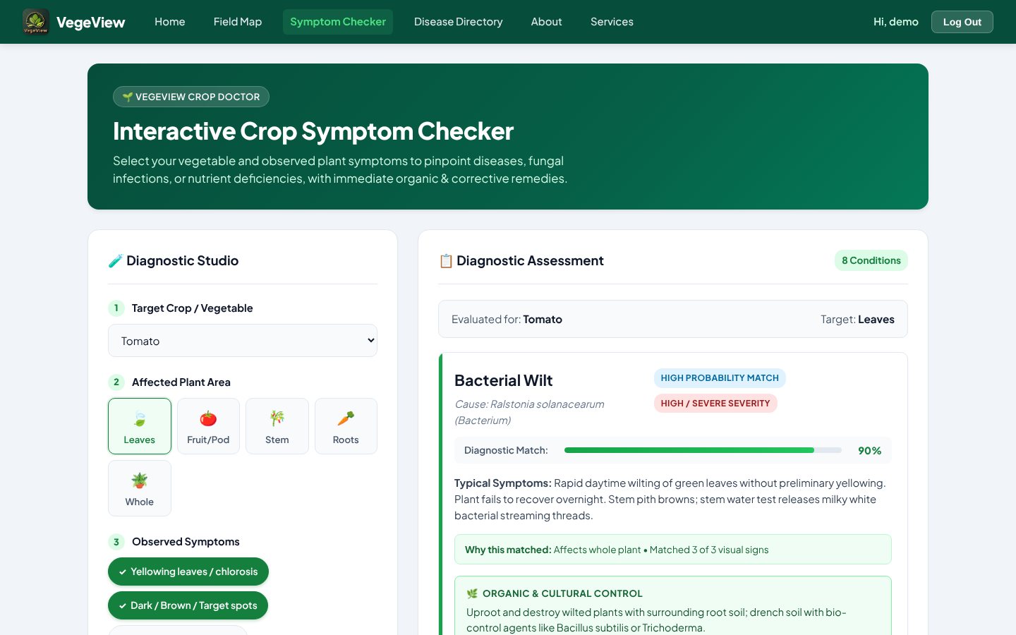
A crop health platform for vegetable farmers. Pick a crop, the affected part and the symptoms you see, and the symptom checker ranks likely diseases, pests and deficiencies with a match score and treatment options. It also has a searchable disease directory and a field map for saving farm boundaries.
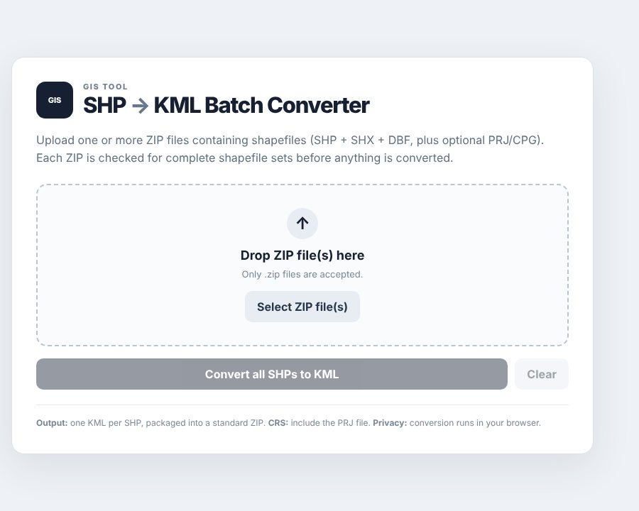
Convert shapefiles to KML in bulk. Upload ZIP files and each one is checked for a complete shapefile set before conversion. You get one KML per shapefile in a single ZIP, and nothing is uploaded to a server.
Tap any point to see what I did there. Use the buttons to show or hide each layer.
6.5244°N 3.3792°E
Boundaries, rivers and lakes from Natural Earth. Pins mark the project site, study area or campus.
Experience
GIS Analyst and Operations OfficerCurrent
Aerial Advantage Global · Lagos
Geospatial data acquisition and analysis for survey, infrastructure and construction projects, including the Lagos–Badagry Expressway and Lagos–Calabar Coastal Highway.
Process photogrammetry and LiDAR data into orthomosaics, DSMs, DTMs, 3D models and topographic data.
Analyst II, GIS & Data SystemsCurrent
GISCleric International · Fully remote
Spatial analysis and image interpretation for client projects.
GIS products with ESRI tools, spatial database management, quality control and training.
Geographic Information Systems Analyst
Segdam Planning Services Limited · Osun
Geospatial support for the Ile-Ife territorial map and the EIA of Kwara State University of Education.
Custom GIS tools in Python and ModelBuilder.
Geospatial Data Scientist
OEA Consults Ltd · Lagos
PyQt desktop app and Django web app for data upload, validation and visualization.
Python pipeline for street data collected across Nigeria for digital twin modelling.
Geographic Information Systems Analyst
Cooperative Information Network (COPINE), NASRDA · Ile-Ife
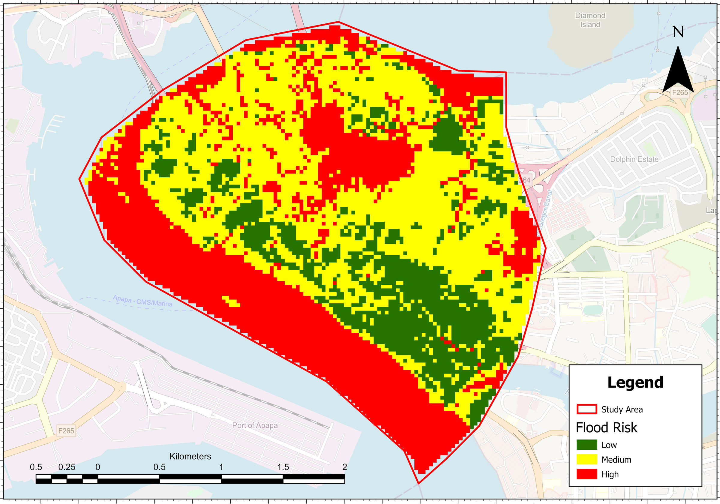
From my study on flood risk vulnerability in Lagos Island Local Government Area. The map classes the area into low, medium and high flood risk, and I checked it against 20 random ground-truth points.